
CHASING X Industrial ROV Reveals Severe Pile Scour in Venezuela’s Caroní River
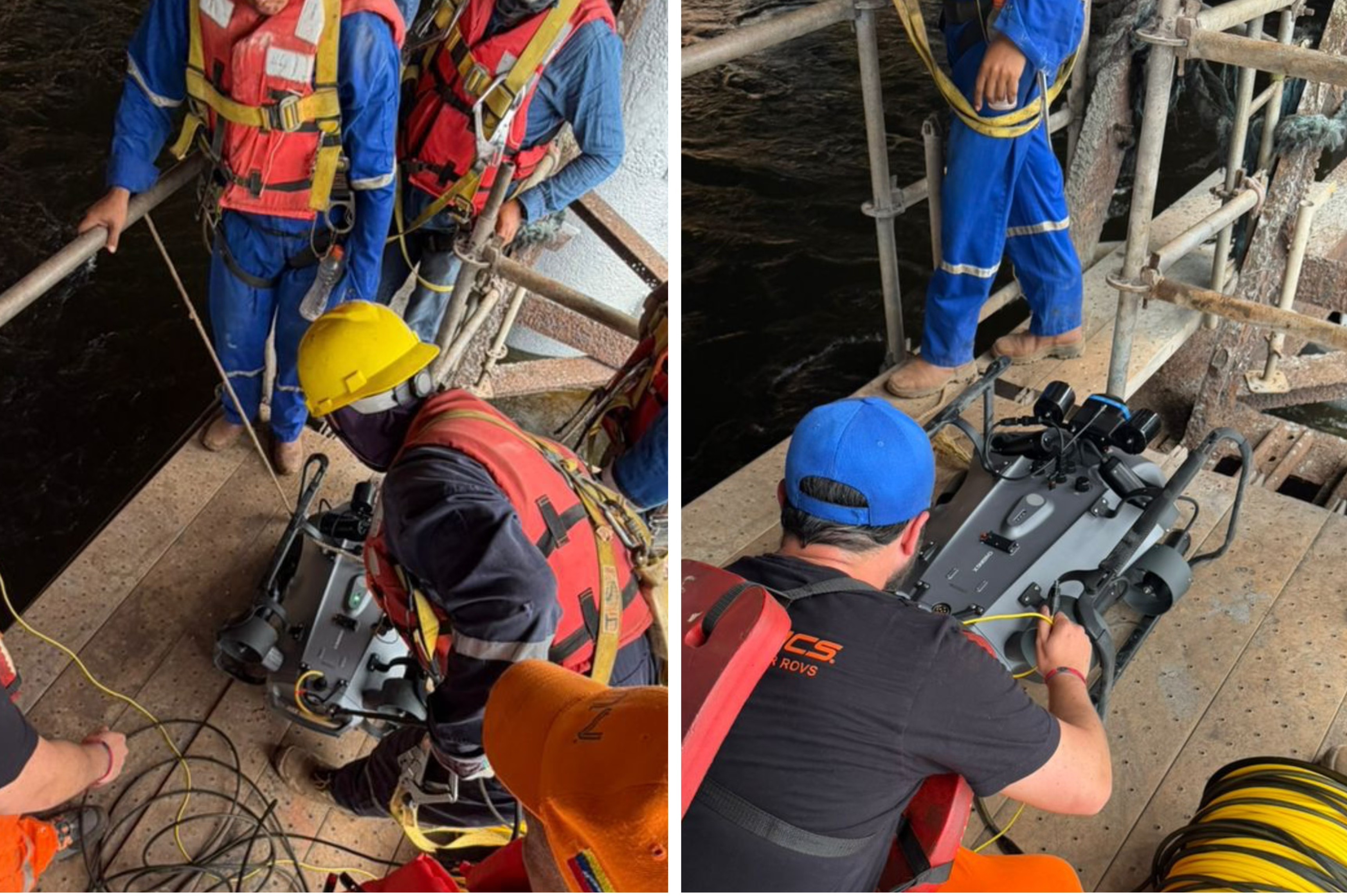
INMARVENCO technicians prepare the CHASING X industrial ROV for an underwater pile inspection in Venezuela’s Caroní River.
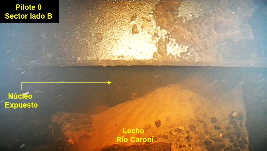
Underwater inspection footage shows significant scour around Pile 0, with the exposed pile core and Caroní riverbed marked in the image.
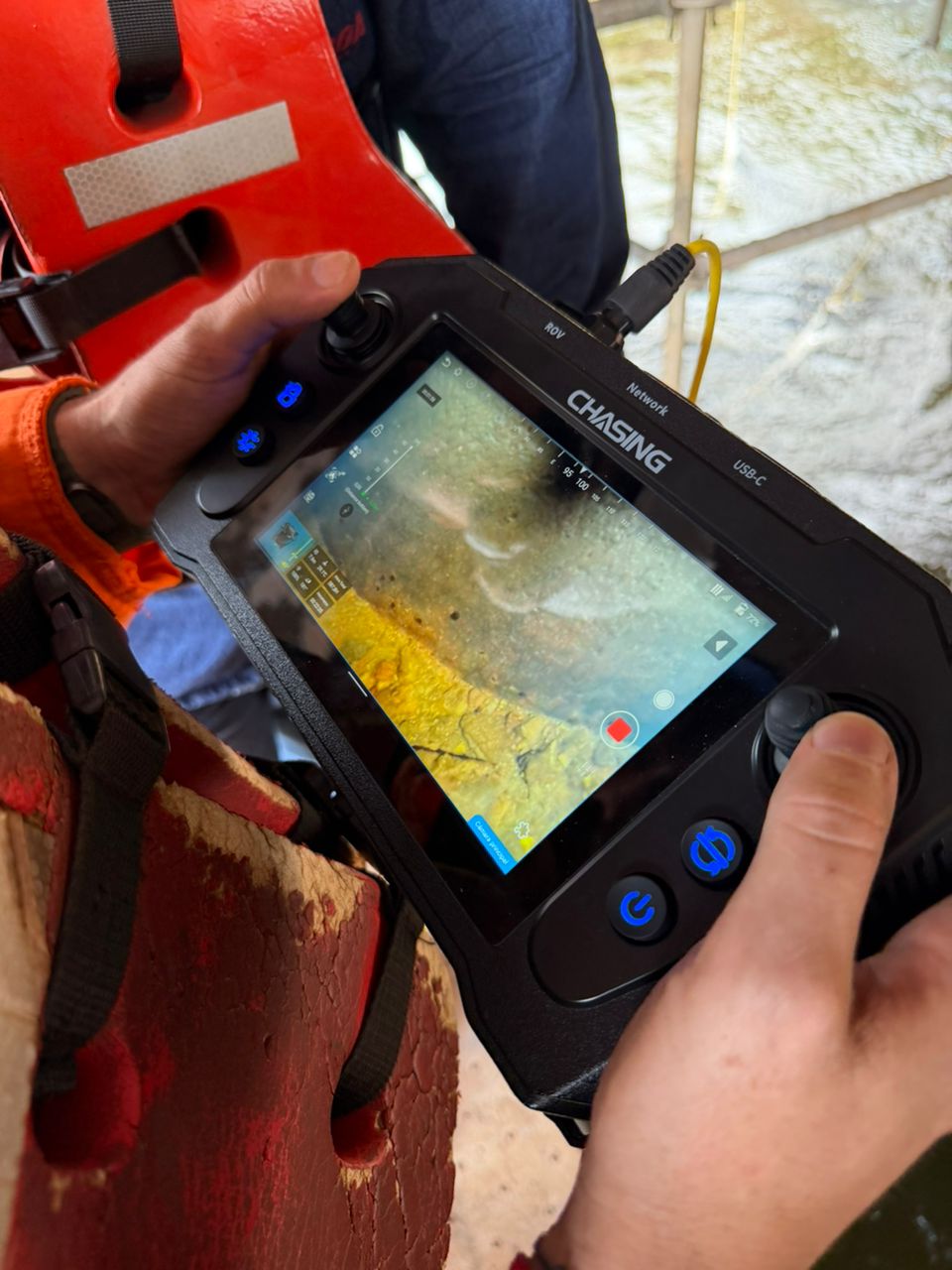
An operator monitors live underwater video from CHASING X during the Caroní River pile scour inspection in strong-current, low-visibility conditions.
INMARVENCO used CHASING X in 4.5-knot currents to reveal severe scour at one pile while a nearby pile showed no comparable damage.
CIUDAD GUAYANA, VENEZUELA, July 23, 2026 /EINPresswire.com/ -- Two adjacent piles stood in the same section of Venezuela’s Caroní River. From above the waterline, there was little indication that their conditions were different.
An underwater inspection revealed otherwise.
Around Pile 0, riverbed material had been swept away, leaving the pile core exposed. Around nearby Pile -1, no comparable scour or foundation exposure was observed within the inspected area.
CHASING has released details of the inspection, which was completed in May 2026 by Venezuela-based marine and underwater engineering service provider INMARVENCO C.A. The team deployed the CHASING X industrial ROV in the river’s Lado B area to inspect the piles and surrounding riverbed.
The difference between the two piles became the central finding of the project. Although both structures were located in the same river section, the underwater evidence showed that they did not share the same risk profile.
Pile scour develops when continuous flow and local vortices remove sediment from around submerged foundations. Over time, the riverbed may be lowered and sections of a pile that were previously buried may become exposed. Because the process occurs below the waterline, it can remain difficult to identify through surface observation alone.
At Pile 0, the pile scour inspection documented significant riverbed loss and an exposed pile core. The project team marked key locations in the collected imagery, including “Núcleo Expuesto,” or exposed core, and “Lecho Caroní,” referring to the Caroní riverbed.
At Pile -1, the inspection found no similar level of scour or foundation exposure within the area examined. The contrast provided evidence for determining which location required priority engineering review instead of assuming that every pile in the same waterway faced an equal level of risk.
Before the team could document that difference, however, the ROV first had to reach and remain near the structures under conditions more demanding than initially expected.
The operation had been planned around currents of approximately 3.0 knots. After the ROV entered the water, on-site telemetry recorded peak speeds of 4.5 knots. The stronger current increased the potential for vehicle drift, tether movement and changes in camera angle, while turbulent flow developed around the piles.
Suspended sediment created another limitation. As optical visibility decreased, conventional video alone could no longer provide sufficient awareness of the piles and surrounding riverbed.
INMARVENCO therefore adopted a sonar-first inspection workflow. An Oculus 750d multibeam imaging sonar generated acoustic images of the pile outlines, riverbed features and nearby obstacles. After areas of interest were identified, CHASING X moved closer to collect 4K video for visual confirmation.
The workflow allowed sonar to establish the location and surrounding conditions before close-range imaging documented the observed abnormalities.
CHASING X uses an OctoDrive eight-thruster vectored propulsion system and AnchorX omni-directional current resistance. During the project, these systems worked with DVL-assisted positioning and attitude control to support the inspection under peak 4.5-knot current conditions.
Live video, telemetry and vehicle status were transmitted to the surface control station. Operators adjusted the route, viewing distance and camera angle in real time while recording sonar scans, 4K footage and annotated images for subsequent analysis.
The collected data did more than confirm that scour was present. It showed where the abnormality was located, how the riverbed had changed and how conditions differed between two neighboring structures.
For teams responsible for underwater infrastructure, that distinction can directly affect engineering review and maintenance planning. Data collected around Pile 0 provided evidence for follow-up assessment and possible repair planning, while Pile -1 offered a nearby comparison point.
The sonar scans, 4K footage and annotated images can also be retained as a baseline for future inspections. Teams can return to the same locations to determine whether the scour has expanded, stabilized or changed following repair work.
Industrial ROV inspection can also support initial screening in strong-current, low-visibility water before commercial diving or another intervention is considered, reducing personnel exposure during early condition assessment.
The Caroní River inspection showed that proximity does not always mean equal risk. Two piles stood in the same river section, but below the waterline, their conditions were markedly different. The combination of sonar, positioning and close-range video made that difference visible, reviewable and available for further action.
About CHASING
Founded in 2016, CHASING develops and manufactures professional and consumer underwater ROVs and related underwater imaging and inspection technologies. Its professional product portfolio supports offshore platform inspection, underwater infrastructure inspection, underwater emergency response, hull and dock inspection, aquaculture and fisheries, scientific research and environmental monitoring, border security and public safety, and underwater 3D imaging and exploration.
For more information, visit https://www.chasing.com/en/chasing-x-overview.html?utm_source=pr_distribution&utm_medium=pr&utm_campaign=CHASINGHX_20260723
Project information and images courtesy of INMARVENCO C.A.
yang xiaoyang
CHASING INNOVATION TECH CO.,LTD
+86 159 2852 4095
email us here
Visit us on social media:
LinkedIn
Instagram
Facebook
YouTube
TikTok
Legal Disclaimer:
EIN Presswire provides this news content "as is" without warranty of any kind. We do not accept any responsibility or liability for the accuracy, content, images, videos, licenses, completeness, legality, or reliability of the information contained in this article. If you have any complaints or copyright issues related to this article, kindly contact the author above.
